Aerial helicopter recon of your land involves the Senior Staff Architect from the HOME ARCHITECTS ® traveling to your land, and then using a mini-helicopter equipped with HD cameras to create videos and photos of your property from various heights and angles from the air.

This is normally accomplished as part of this architectural company’s Walk Your Land With The Architect service, in which they meet you at your property, anywhere in the USA, or world, then walk your property, examining the potential for your improvements at various locations.
By “improvements”, the idea is that you would be interested in building a house, barn, driveway(s), cottages, outbuildings, trails, water features, or other elements on your acreage.
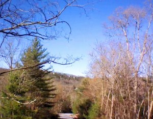
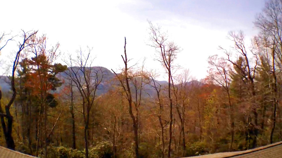
Part of this investigation now involves the launching of the firm’s aerial helicopter to perform reconnaissance of your land. The aerial drone used by this company allows them to obtain a better view of your land from the air, seeing what may not be clearly visible through all your trees and bushes. For instance, there may be a spectacular view on the other side of your trees, if only you could get high enough to see over them. The “HA Aerial Helicopter Recon Drone” (the title of this company’s mini-helicopter) give them the ability to accomplish this. The drone also helps give you the “big picture,” enabling a comprehensive total single view of your land, or at least, major portions of it.
Reconnaissance of Your Land using an Aerial Helicopter
The Architect can also control the rotation of the drone, providing a 360* view(s) of your land, by means of continuing to record the video while rotating the helicopter. A breathtaking video results, giving Clients an amazing perspective on their estate.
The Architect controls the helicopter by means of an iPad, connected through a “hot spot” to a cell tower. The iPad downloads the application software. Their are 2 main “attitude” controls on each side of the screen that function in a joystick mode. The right control adjusts ascent, descent, right rotation and left rotation. The left control moves the drone forward, backward, and left and right. There is another control that launches, and another that lands. Another control starts and stops recording and another changes cameras from the font-mounted to the bellycam (for straight down imagery).
The helicopter can be difficult to control, particularly in the wind, so when you take your hands of all the controls, the drone stops and hovers. This can be a godsend, when unexpected directional movement occurs. You stop, then reassess which direction the helicopter needs to move to take it to where you want it to be located.
The aerial videos/photos work hand in hand with the Architectural firm’s land-based digital photos and investigations obtained from driving around the land in 4x4s, ATVs, or by walking. The Architect listens to their Clients describing what they want to accomplish on their land, take notes, asks questions, makes comments, makes observations and points out possibilities.
The firm leaves, after the site reconnaissance is done, then prepares and PDF report and transmits it to their Client for their information. All sorts of information is contained in the report, including, but not limited to: eye-level photos of various locations for the main house site, possible septic, well, driveway, outdoor living and recreational and agricultural areas, possible garage location, vehicular circulation, backup and guest parking, pastureland, stables, storage facilities, primary view directions, prevailing breeze and other important aspects that can affect the design of the house and other improvements.
tags: Aerial helicopter recon of your land, Cashiers, Sevierville, Nashville, Atlanta, Asheville, Highlands, Lake Toxaway, Glenville, Sapphire, Cullowhee.